A general guide to California travel: discovering the Golden State
California is the third-largest state in the United States by land area, stretching nearly 900 miles from the Mexican border to the Oregon state line. Because of its massive size, the state contains some of the most geographically diverse terrain on earth. The landscape is structurally divided by two major mountain ranges running north to south: the Coast Ranges, which drop directly into the Pacific Ocean, and the Sierra Nevada range, which shields the fertile Central Valley from the eastern high desert. This unique geography means travelers can experience dramatically different environments, from rugged shorelines and sun-warmed agricultural plains to massive alpine peaks and deep desert basins, all within a single day of driving.
The physical configuration of this land mass forces weather patterns to shift dramatically across incredibly short distances. As Pacific storm systems move inland, they run directly into the sheer vertical walls of the coastal bluffs, dropping moisture that feeds dense redwood forests before drying out over the massive interior valley. This creates an interconnected system of isolated regions, each developing its own distinct climate, plant life, and local culture. The transition from the saltwater coastline to the sun-soaked interior basin highlights the deliberate pacing of the California landscape. It provides an expansive framework for an intentional journey, serving as a reminder that the true depth of the state lies far beyond the familiar coastal highway lookouts.
The sweeping transitions of the Pacific edge

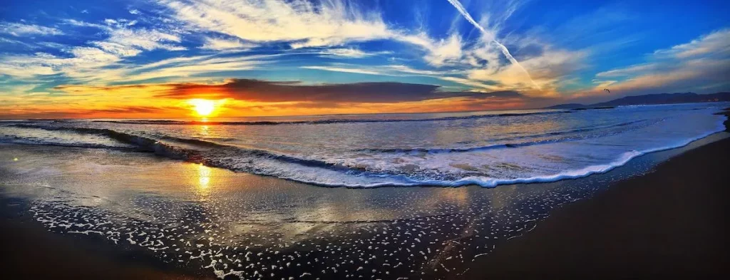
California’s coastline varies dramatically from south to north, creating an expansive geographical continuum that completely transforms the travel experience as you cross regional thresholds. Southern California, stretching from San Diego to Santa Barbara, is famous for wide, sandy beaches, warm sunshine, and gentle surf swells that drive a prominent global beach culture. The environment here is defined by long, sun-drenched days where low-lying coastal plains allow golden light to wash over expansive shorelines. This open geography encourages a lively connection to the water, drawing crowds to the iconic piers and beachfront boardwalks that stretch uninterrupted across the sandy horizons.
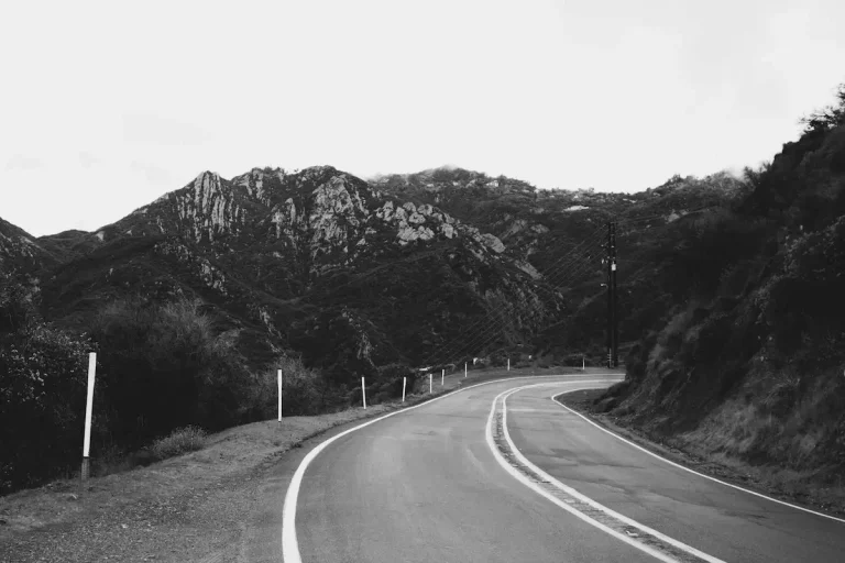
As you travel north past Point Conception, the topography shifts rapidly, transitioning from flat, sun-warmed expanses to a landscape of sheer vertical drama. The Central Coast features steep, dramatic cliffs and dense pine forests that edge directly against the water, forming a rugged boundary where the mountains meet the sea. This region is home to winding cliffside roads and iconic arched stone bridges that span deep coastal canyons. The marine environment becomes more dynamic and unpredictable, as massive ocean swells crash violently against rocky headlands and hidden, crescent-shaped coves. It represents a highly exclusive landscape tailored for travelers who appreciate raw, majestic scenery over traditional beach activities.
Further north, past the entrance of San Francisco Bay, the terrain shifts once again into an untamed and mystical coastal wilderness. The Northern Coast, tracking up to the redwood forests, is defined by cold sea fog, massive sea stacks, and a rugged, isolated feel. The beaches here are often composed of dark sand and smooth pebbles, bordered by towering stands of ancient timber that thrive in the rich, moisture-heavy air. Thick layers of marine fog regularly roll inland, blanketing the isolated sea stacks in a silent, silver mist that deepens the sense of remote solitude.
The coastal highway, known as Highway 1, connects these diverse regions, providing a continuous path through changing landscapes. Despite the visual warmth of the southern beaches, strong offshore currents and deep-water upwellings mean that coastal water temperatures remain chilly year-round. Sea temperatures range from the low sixties in the south to the low fifties in the north, serving as a constant reminder of the wild, untamed power of the Pacific Ocean.
The protected havens of interior wine valleys
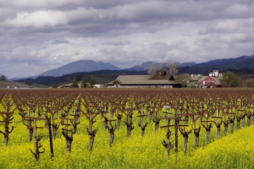
Just behind the immediate coastal mountain ridges lie the state’s highly fertile interior valleys, protected from the cold ocean winds by massive walls of stone and earth. While the expansive Central Valley spans hundreds of miles to serve as the dominant agricultural heartland of the country, a series of smaller coastal valley pockets are dedicated entirely to world-famous, boutique wine production. These sheltered basins are uniquely shaped by their proximity to the mountain chains, which act as a physical shield against aggressive marine weather while trapping the warm, reliable sunshine needed to cultivate exceptional crops.
The northern valleys, including Napa and Sonoma, feature a classic Mediterranean climate ideal for robust Cabernet Sauvignon, old-vine Zinfandel, and crisp Chardonnay grapes. In these northern enclaves, the geography forms narrow, protected corridors where morning fog from the bays rolls across the valley floor, burning away by midday to leave the vines bathed in intense, direct sun. This environmental balance slows the ripening process, allowing the fruit to develop deep, concentrated flavors and complex structures that have earned the region international acclaim. The tight upper basin of Napa provides the ideal setting for a refined, multi-day St. Helena getaway where history and agriculture blend seamlessly.
Further south, the interior basins of Paso Robles and the Santa Ynez Valley operate under a different, equally compelling geographical rhythm. These central and southern valleys enjoy warm, sun-drenched daytime temperatures where summer afternoons routinely climb into the upper registers. This intense daytime heat is beautifully balanced by a dramatic evening cooling shift, as sharp ocean breezes pour through natural gaps in the coastal mountains to drop temperatures by as much as forty degrees in a matter of hours.
Rather than serving as mere agricultural backdrops, these regions function as historic, highly walkable cultural hubs designed for immersive travel. The towns anchoring these valleys emphasize local food movements, estate olive oil production, and beautifully preserved architecture that dates back to the early homesteading eras. It is a setting where travelers can spend days exploring independent downtown corridors, interacting directly with local producers, and experiencing a style of living that is deeply connected to the natural rhythms of the land.
The mountains and high desert
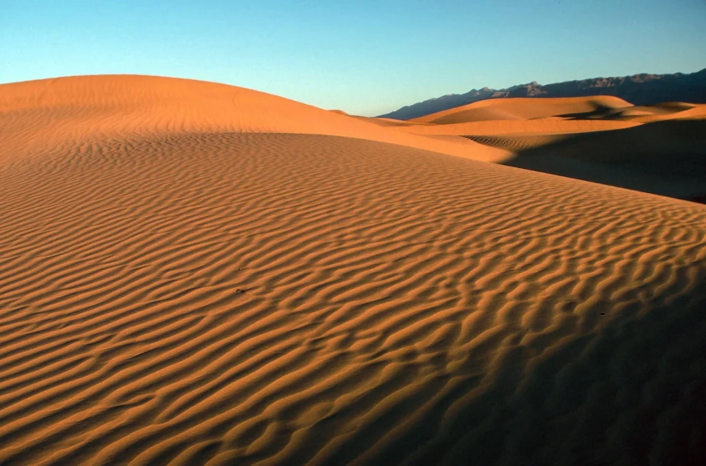
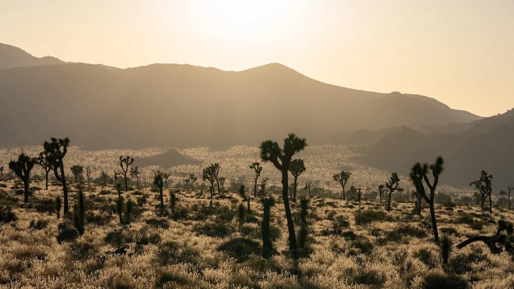
Beyond the towering rain shadows of the southern mountain ranges lie California’s dramatic desert basins, a massive expanse of arid geography that defies the typical coastal imagery of the state. While these regions were once considered impassable obstacles by early pioneers, the unique topography and striking natural formations have transformed the desert interior into an internationally celebrated sanctuary for architectural design and high-end relaxation. The physical environment is shaped by vast alluvial plains, rugged mountain backdrops that glow pink at sunset, and an abundance of native flora like towering palms and twisted Joshua trees.
The climate of the desert interior is defined by intense solar energy, resulting in exceptionally warm daytime temperatures and remarkably clear night skies that draw stargazers from around the world. Because the high mountain peaks block the cool, moist air currents from the Pacific Ocean, the atmosphere remains incredibly dry year-round. This specific atmospheric configuration creates a highly therapeutic climate where visitors can enjoy warm winter afternoons beneath a brilliant blue sky, entirely insulated from the damp chill of the coast.
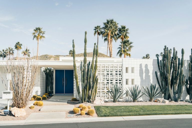
Nestled into the base of the San Jacinto Mountains, the region offers the ultimate Palm Springs getaway where travelers can experience midcentury design, private estate living, and therapeutic mineral springs in a completely secluded desert oasis. This historic resort enclave blends seamlessly with the natural contours of the canyon walls, providing an exclusive retreat that values slow pacing and intentional architecture. The striking contrast between the sharp granite peaks and the flat desert floor creates a visual drama that has captivated creative professionals and design-focused travelers for generations.
Rather than serving as a transient stopover, the desert basins encourage an immersive, multi-day exploration of the rugged terrain and unique local culture. Modern visitors can spend their days exploring independent galleries in walkable downtown blocks, touring beautifully preserved residential estates, or hiking through ancient palm canyons carved directly into the foothills. It remains an essential destination for travelers who equate luxury with open space, architectural permanence, and a profound connection to the stark, commanding beauty of the California interior.
What makes California unique
Beyond its standard regional layout, California possesses a collection of natural wonders and biological extremes that cannot be found anywhere else on the planet. It is the only place on earth where you can stand beneath the tallest living organisms, the coast redwoods, and travel a few hours inland to marvel at the largest trees by volume, the giant sequoias. The coast redwoods thrive exclusively in the narrow, moisture-heavy fog belts of the northern coastline, using the cold marine air to grow over three hundred feet tall. Conversely, the massive giant sequoias drape the western slopes of the Sierra Nevada range, relying on heavy winter snowpack and intense summer heat to produce massive, fire-resistant trunks. Hidden even further inland within the remote, wind-swept heights of the White Mountains are the ancient bristlecone pines, which represent the oldest living non-clonal organisms on earth, with some individual trees verified at over five thousand years old.
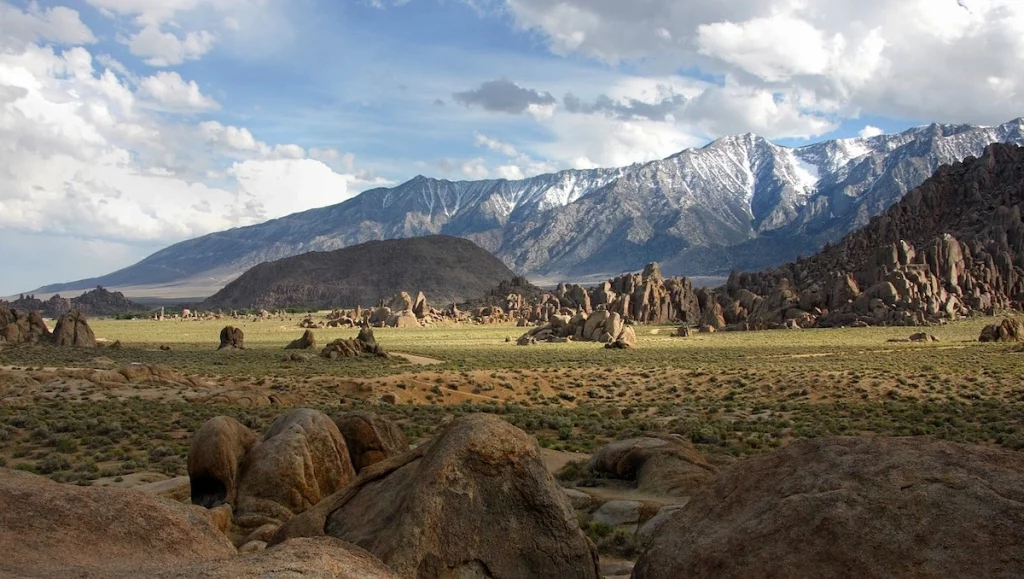
The state also contains the ultimate contrast in North American geography, packing the continent’s most dramatic elevation changes into a remarkably tight geographical footprint. It holds both the highest point in the contiguous United States, Mount Whitney, and the absolute lowest point on the continent, Badwater Basin in Death Valley, positioned just eighty-five miles apart. This radical proximity means that a traveler could stand atop a jagged, snow-capped alpine peak and, within a few hours of driving, descend into a sunken salt crust floor sitting nearly three hundred feet below sea level. This extreme variance in elevation creates a global biodiversity hotspot, hosting over six thousand native plant species and hundreds of endemic animal species that exist nowhere else in the world. This massive density of unique landscapes explains why California is home to nine distinct national parks, more than any other state in the country, offering an unparalleled laboratory of natural wonders for the intentional traveler.
Navigating diverse microclimates and complex transit corridors

Traveling effectively through California requires understanding its distinct transportation networks and shifting microclimates. The state is heavily car-dependent, and major metropolitan areas like Los Angeles and the San Francisco Bay Area experience significant freeway congestion during morning and evening commute hours. To ensure smooth transit, utilize inland valley routes or timed mid-morning departures to bypass urban choke points. Planning trips around these structural peak hours allows travelers to maintain an unhurried pace, transforming a standard transit day into a scenic exploration of the changing landscape. Leaving the main coastal freeways for less traveled regional roads often reveals historic small towns and open agricultural vistas that most drivers entirely miss.
Weather varies wildly by ZIP code due to the marine layer, a thick layer of ocean fog that rolls inland during spring and summer mornings. This atmospheric phenomenon can cause temperatures directly on the coast to sit in the chilly sixties while areas just ten miles inland bask in the nineties under clear skies. Packing versatile layers is an essential practice for any journey across the state, as a fifteen-minute drive through a mountain gap can plunge you into a completely different seasonal environment. Because the natural barriers of the topography create these hyper-local climates, relying on broad regional forecasts rarely provides an accurate picture of what to expect on the ground.
Cross-state transit also requires careful attention to changing seasonal terrain changes and regional regulations. Mountain passes across the Sierra Nevada range regularly close during the winter and early spring months due to heavy snowpack, cutting off direct routes between the central valleys and the eastern high desert. Always check seasonal mountain pass closures before driving across the mountain ranges, and carry required traction devices when entering high-altitude zones during late autumn. Additionally, the immense popularity of the state’s natural landmarks means that high-demand national or state reserves frequently require advanced vehicle reservations and entry permits. Always verify park access rules when planning your arrival to guarantee a seamless, stress-free entrance into these protected spaces.